
Evaluating supervised classification methods in urban environments using UAV images
Resumo
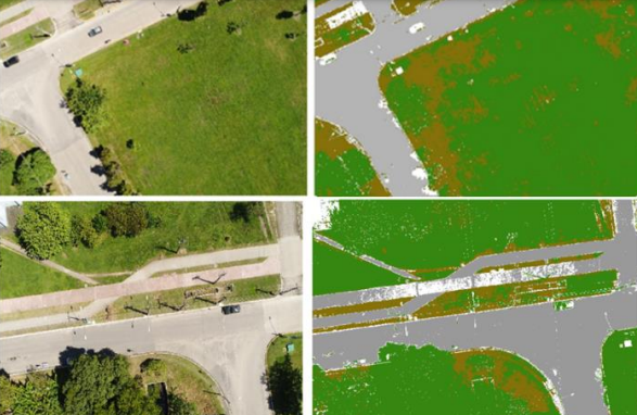
The use, commerce and technological development of Unmanned Aerial Vehicles (UAV’s) is advancing every year with different proposals and applications in different fields of Science. Not too many years ago, aerial studies depended exclusively on images taken from airplanes and images derived from satellites, which usually represent high cost. Image classification allows the production of thematic maps and also allows the user to create an image with well distinguished classes with a good level of accuracy. In the 00’s this process was mainly used in satellite images, but with the expansion of the UAV, new processes and techniques are starting to develop along. This article had the purpose of testing the accuracy of classification through kappa and tau statistics using different classifiers (Maxver, Maxver-ICM and Euclidean Distance) in aerial images, two with a short number of details and better distinguished classes and an orthophoto containing a high number of features.