
Forest fire monitoring in Angolan National Parks between 2008 and 2017
![]()
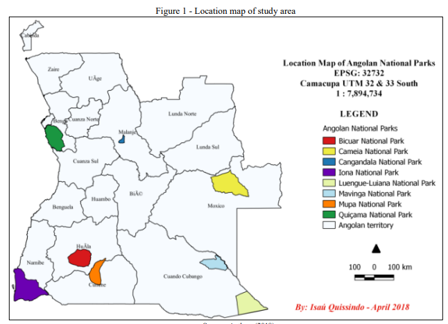
The number of forest fires has increased considerably throughout the world. Forest fires are a major cause of damage to terrestrial ecosystems, and National Parks (NP) and Reserves. So it contributed to the increase of research on the theme. The limitations to know the recording of hotspots in Angola using fire detection tower can be met by using techniques and data from GIS and remote sensing. So, this paper aims to monitor the occurrence of forest fires in Angolan National Parks (Iona, Cameia, Quiçama, Cangandala, Mavinga, Bicuar, Luengue-Luiana and Mupa) in the decade 2008-2017 using data from NASA Modis Collection 6 on Protected Areas, that was obtained in Nasa Firms Project and World Database on Protected Areas, relatively. The data was processed in ArcGis version 10.1, Quantum Gis version 2.18 and Google Earth Pro. The main results obtained in this study are described ahead. Most of the forest fires occurred between June and September, which may be associated with the dry season. The Cameia, Luengue-Luiana and Mavinga NP had higher forest fireoccurrences and Iona, Cangandala Quiçama and Mupa NP lower. The average forest fires occurrences between 2008-2017 in study area is 21347, and the average per year is 2135, per month 178 and per day 6 in each Angolan NP. The forest fire in the Angolan NP between 2008-2017 occurred mostly in the day (97 %) in relation to the night (3 %) time.