
Geographic Information System applied to Forest Management in the Miombo Forest Polygon in Cambiote (Huambo, Angola)
![]()
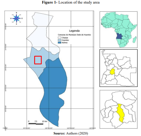
This paper aimed to study the applications of Geographic Information System in forest management in the Miombo forest polygon in Cambiote (Huambo). The survey was carried out between October 2019 and August 2020. Data collection was carried out in two stages: geospatial data (NDVI, land use, administrative boundaries) on web servers (United States Geological Survey, European Space Agency, Map library); traditional forest inventory data that included geoprocessing applications and techniques. In this stage, three rectangular sample plots measuring 25 x 20 m (500 m2) were marked and georeferenced. The results showed that geoprocessing techniques in forest management help in locating plots and understanding their spatial distribution within the Miombo forest and their floristic composition, clearly showing the occurrence of species through the maps. The analysis of forest inventory data from a dendrometric and spatial perspective allowed the study of a population of 212 individuals, with emphasis on the species Ochna schweinfurthiana with 54 individuals, Brachystegia boehmii 66 and Parinari curatellifolia 31. The average basal area per hectare was 0.7, the average volume per hectare was 1.7 and the average number of individuals per hectare was 140. The analysis in the spatial perspective showed greater spatial distribution, in the study area, of these species. Therefore, it was recommended that further studies be carried out on the spatial distribution of Miombo woodland species, in order to guarantee the conservation and sustainability of species with high energy, edible, medicinal and other values.